
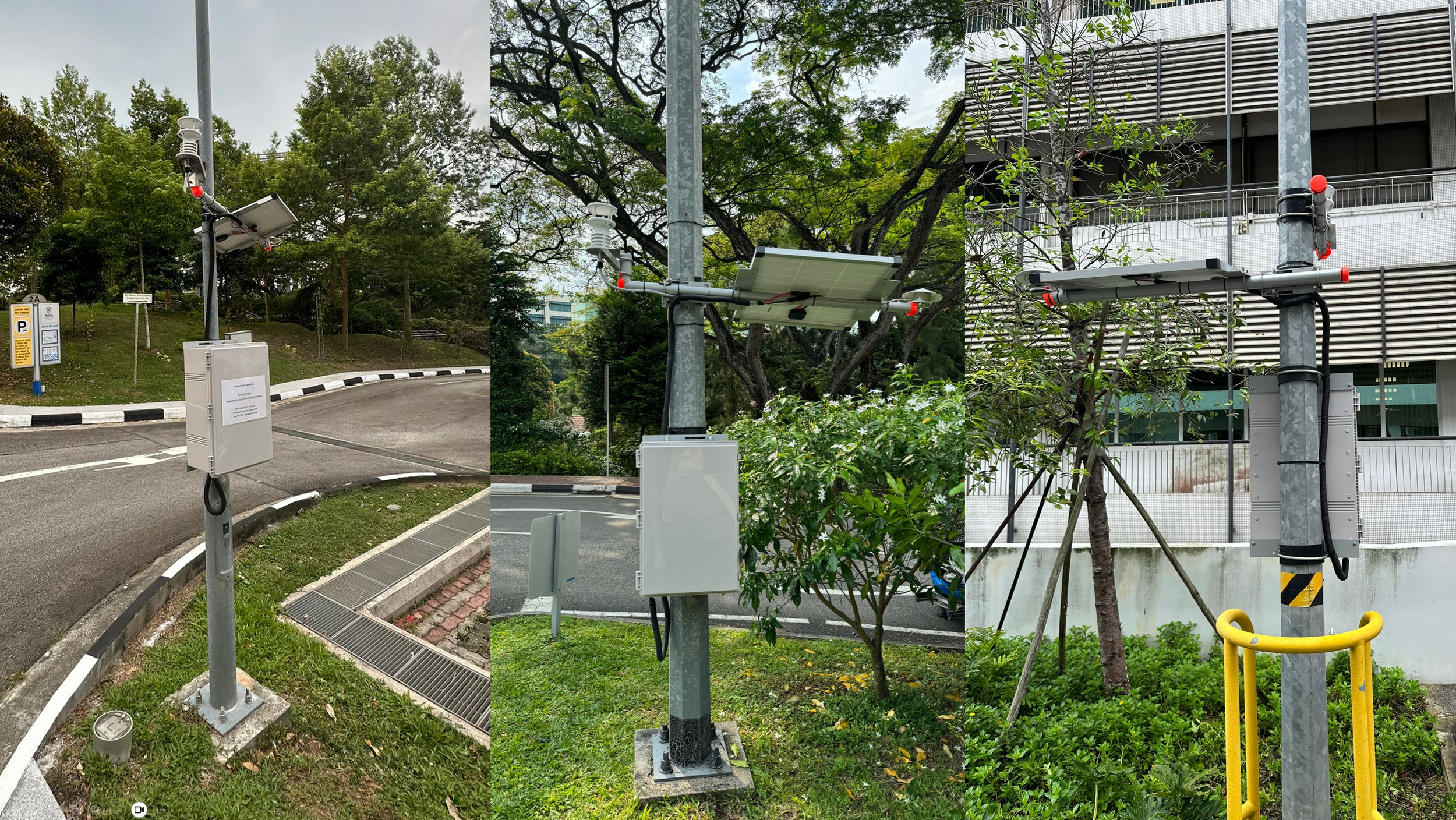
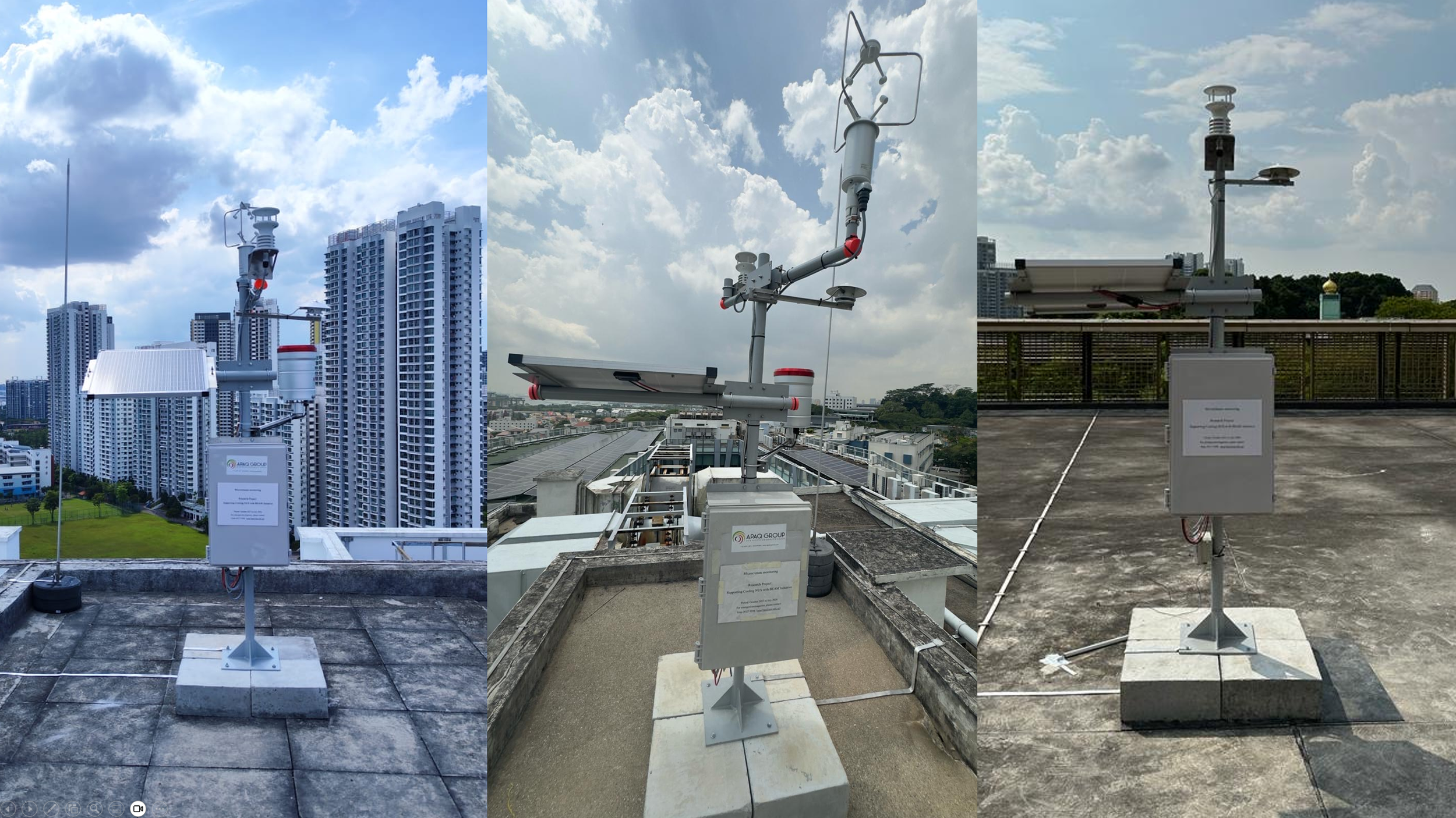
Sensor network
One of Singapore's densest campus microclimate networks — 49 instruments deployed across NUS Kent Ridge from late 2023 to April 2024, forming the empirical backbone of the BEAM Digital Twin.
Deployment began in late 2023, with all 40 stations fully operational by end of March 2024. Ground-level units are mounted on existing lamp posts across the campus — requiring no new infrastructure. Eight rooftop units, installed at key buildings, capture conditions above the urban canopy layer.
Three rooftop stations are equipped with additional instruments: a 3-axis ultrasonic anemometer (LSI DNB146) for full three-dimensional wind measurement, and a rain gauge (LSI DQA230.1) for rainfall monitoring. Data is logged continuously at 1-minute intervals.
replace with your photo
replace with your photo
| Parameter | Sensor | Range | Accuracy | Resolution |
|---|---|---|---|---|
| Air temperature | LSI DNB200 | −40 to 80°C | ±0.3°C | 0.1°C |
| Relative humidity | LSI DNB200 | 0–100% | ±3% | 0.1% |
| Wind speed | LSI DNB200 | 0–60 m/s | ±0.3 m/s | 0.01 m/s |
| Wind direction | LSI DNB200 | 0–360° | ±3° | 0.1° |
| Wind speed (3-axis)* | LSI DNB146 | 0–70 m/s | ±1% | 0.01 m/s |
| Solar irradiance | LSI DPA863 | 0–1500 W/m² | ±10% | 1% |
| Rainfall* | LSI DQA230.1 | 0–500 mm/h | ±0.2 mm | 0.2 mm |
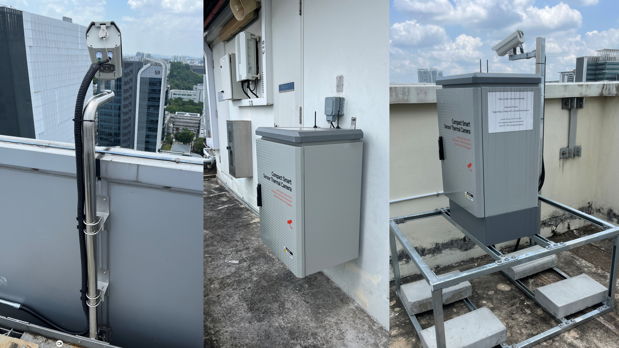
The first camera began data collection in December 2023, with all six fully installed by end of February 2024. Each camera is mounted on a rooftop and connected to a mini-PC housed inside a weatherproof ventilated box, enabling year-round continuous operation in Singapore's humid tropical climate.
The cameras produce two output streams: a thermal infrared image (464 × 348 px) capturing surface temperatures across the field of view every 30 minutes, and a visible reference image for environmental context every hour. Together they reveal how building surfaces, pavements, and rooftops heat up and cool down across the day.
replace with your photo
| Specification | Value |
|---|---|
| Infrared resolution | 464 × 348 pixels |
| Field of view | 95° × 74° |
| Spatial resolution | 4.0 mrad/pixel |
| Temperature range | −20°C to 175°C |
| Accuracy | ±2°C (within −20°C to 100°C) |
| Thermal image interval | 30 minutes |
| Visible image interval | 60 minutes |
| Housing | Weatherproof ventilated box + mini-PC |
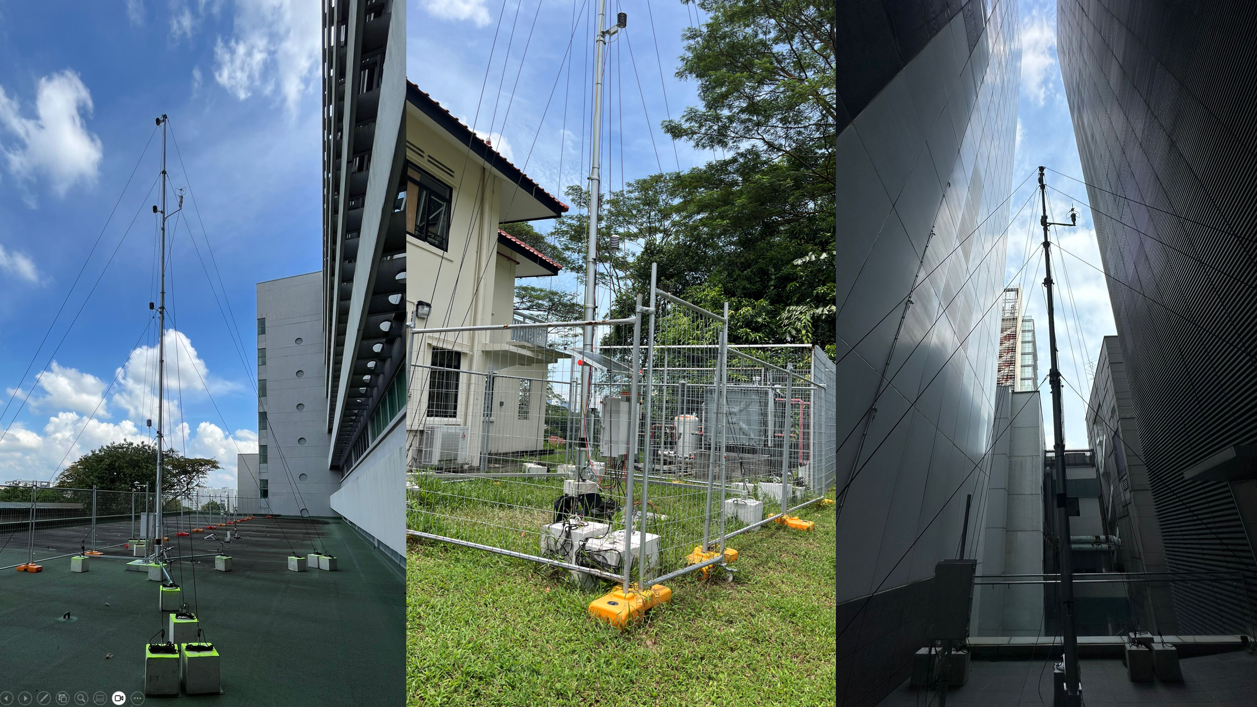
The first tower began data collection in January 2024, with the final tower completed in April 2024. Unlike the weather stations which capture single-height conditions, the met towers measure vertical atmospheric profiles — revealing how temperature, humidity, and wind vary from pedestrian level up to 12 m above ground.
The tower at MD1 carries an additional set of surface temperature sensors at five heights (1.5, 3, 6, 9, 12 m), measuring the adjacent building façade — providing direct data on how building surfaces contribute to the surrounding microclimate.
replace with your photo
| Parameter | Sensor | Range | Accuracy | Resolution |
|---|---|---|---|---|
| Air temperature | LSI DMA672.1 | −50 to 100°C | ±0.1°C | 0.01°C |
| Relative humidity | LSI DMA672.1 | 0–100% | ±1% | 0.1% |
| Wind speed & dir. | LSI DNB146 (3-axis) | 0–70 m/s · 0–360° | ±1% | 0.01 m/s · 0.1° |
| Solar irradiance | LSI DPA863 | 0–1500 W/m² | ±10% | 1% |
| Surface temperature* | LSI DLE124A | −50 to 80°C | ±0.15°C | 0.01°C |